Cherry lodge LANDFILL Action Group
Plans and proposals
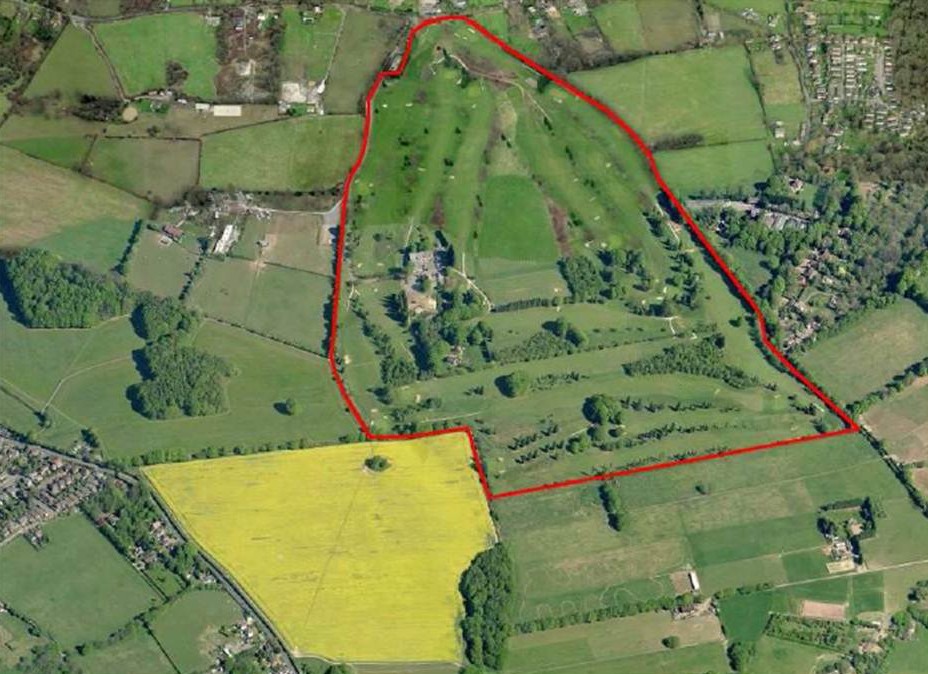
| This aerial view shows the golf club, within the red outline, in relation to the surrounding area. The A233, Main Road, can be seen in the bottom left of the picture. Strawberry Field is the yellow field in-between. |
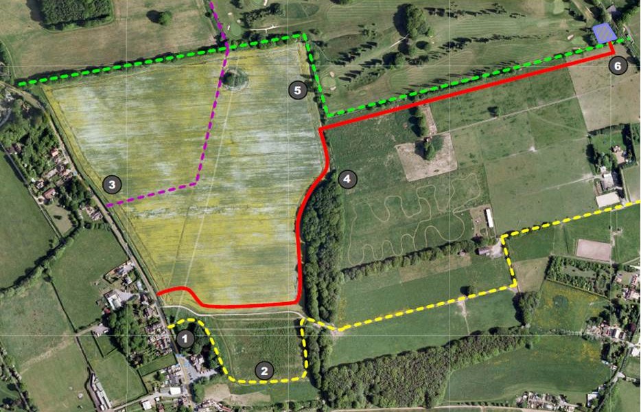
| This plan shows the new layouts for the public rights of ways. The red line shows the route of the proposed haul road leading from Main Road to the golf course. The green dotted line is a bridleway which is crossed by the haul road at point 6. The yellow dotted line show the new route, of the first section, of the existing footpath. There will be a new entrance onto Main Road at point 1 (only 80cm wide!), and it will skirt the small section of Strawberry field. The purple dotted line is a byway/bridleway that crosses the field diagonally. It is proposed that this path will be diverted to a point on Main Road at point 3. |
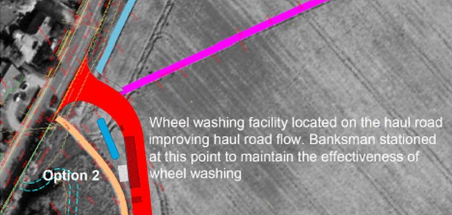
| This plan shows the haul road (in red) where it meets with Main Road and the wheel washing facility. |
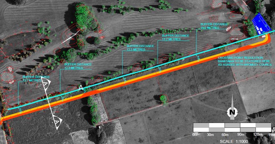
| This one shows the southern edge of the course, the existing bridleway (in light blue) and the haul road running parallel to it. Note also the blue area at top right. This is going to be where the haul road enters the golf course and crosses the bridleway. |
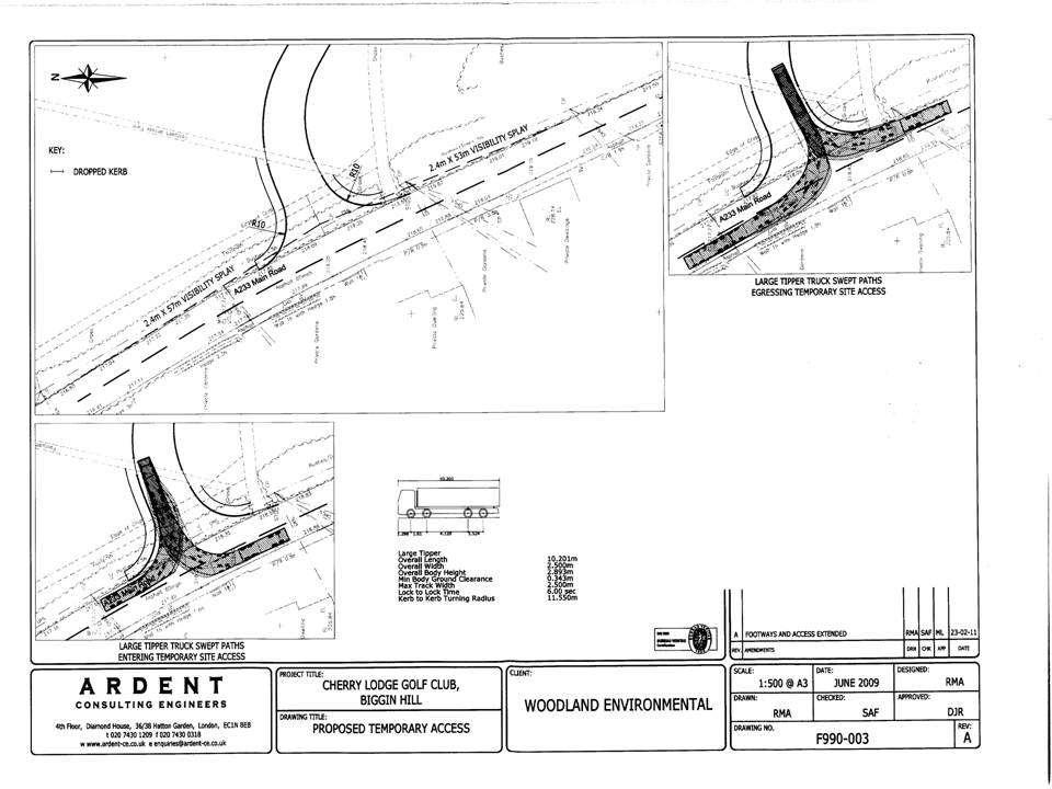
| This final plan shows how they propose to construct the entrance to the site where the haul road meets Main Road. The darker lines on the two smaller plans show the routes taken by the lorries as they enter and exit the haul road. It also shows how much of the hedgerow either side of the entrance they intend to remove. |
Have your say. Click on the image to sign our guestbook.